Storytelling Drones

“Stories have to be told or they die, and when they die, we can't remember who we are or why we're here.” – Sue Monk Kidd
The desire to tell stories connects generations across times and locations. From oral traditions, to pen and paper, to blog posts like this one, the medium of storytelling continues to evolve. Before joining Clarity, I had a chance to collaborate with Chris Bunin, a geography teacher at Albemarle High School in Charlottesville, Virginia, to experiment with a fresh and different approach to spin a tale: Using drones to tell the stories of James Madison's Montpelier.
Storytelling Takes Flight
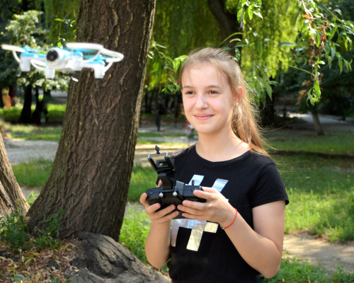
In the fall of 2019, storytelling took flight for Chris Bunin’s geographic information system (GIS) students with the progression of sounds consisting of a buzz of motors, mouth agape silence, excitable laughter, and relieved exhales. As the class became more adept at drones, students learned the art of photogrammetry, making 3D models from images by studying aerial photography. Soon they saw the drones for far more than the thrill of guiding a device around their school’s campus to snap pictures. Together, Mr. Bunin and I facilitated his students through brainstorming protocols to generate ways that the drone could help them tell community stories through GIS software.
Chris Bunin connected the students’ insights about drone storytelling to a Montpelier initiative that had been years in the making. The staff at Montpelier had been working diligently to share stories from the estate’s history, preserving narratives about the Madison family while creating a greater balance in sharing experiences from the perspective of enslaved people. The Montpelier staff had already created interactive installations, audio interviews from descendents, and modern visual documentaries on the legacy of slavery.
Chris Bunin, his students, and the staff decided to use location-based images and videos from the drone to map the Madisons’ house, the South Yard homes for enslaved people, a freeman's cabin, and a train station. Together, they all felt that the new stories could be told using story maps—GIS tools that combined maps, text, images, videos, and external links into a cohesive presentation.
Lift Off at Montpelier
One of the ways drones enlighten learning is by showing students a perspective never before possible (or at least not easily feasible). Prior to the visit, students created automated flight plans for each of Montpelier’s areas in order to capture the entire estate. When the drones drifted into the airspace above Montpelier, students experienced a consistent pattern of discovery:
- Around 25 feet in the air, students start to realize the limits of how fast the drones could zoom across the field in front of the Madison’s home.
- At a height of 100 feet, students catch the first view of the vast collection of buildings below including the South Yard—home to the enslaved people—and an ongoing archeological dig site.
- Reaching an elevation of 200 feet above the ground, nearby Shenandoah National Park with its blue-tinged mountains comes into sight.
- Surpassing 350 feet, the whole perspective-shifting expanse of the estate comes into view connecting homes, fields, time periods, and, most importantly, whole communities into view.
The students imported hundreds of videos and images into photogrammetry software after the drones touched down. Back in their classroom, the students created interactive story maps that could be shared with learners across the country who did not have access to the place-based experiences found by visiting Montpelier.
Screenshot from student story map “A field trip to Montpelier by AHS” including a picture of a student group meeting with a local historian.
"Storytelling is among the oldest forms of communication. Storytelling is the commonality of all human beings, in all places, in all times.” – Rives Collins
Quickly, students in other classes discovered that drones were versatile storytelling tools that allowed them to access, interpret, create, and share stories on a—literally—higher level. Over the rest of the school year, photography and video production students used the drones to capture new perspectives and aerial shots; biology classes analyzed plant health around campus using photogrammetry analysis tools. Whenever students or educators saw a situation where drones could help them solve a problem or connect to class content, I partnered with the class and helped make it become a reality.
Angie Foreman’s Project-based Learning experiences and Chris Bunin’s historical storytelling projects prompted administrators to expand drone access to more schools and students. The students’ joyful exploration of the world around them produced rich learning with deep connections to reading, science, history, and geography sparking a desire to ask questions, solve problems, and share stories. For educators looking to elevate learning, drones are a great tool to inspire their students.
I truly believe that there is a natural inclination within all of us to tell stories. In telling stories, we connect with each other, our past, and our future. From the fanciful, imaginative play of my five-year-old son and his friends to the covert comics that my nine-year-old scribbles in his notebook just for himself, to the innumerable videos on TikTok, storytelling is firmly a part of the human condition. So why not with drones?